Hurricane Milton – A Looming Threat to Tampa As Hurricane Milton barrels towards the Florida coastline, residents of Tampa are bracing for what experts warn could be a historic event. This fierce Category 4 hurricane is expected to make landfall tomorrow, potentially delivering a powerful storm surge and catastrophic winds to an area not directly hit by a major hurricane since 1921. Current Status of Hurricane Milton Originally a Category 5 storm, Hurricane Milton has slightly weakened but remains a formidable threat with sustained winds of 145 mph. The National…
Read MoreTag: storm surge
State Farm Faces Unprecedented Claims Surge as Hurricane Beryl Breaks Records
Hurricane Beryl Smashes Records, Unleashing Insurance Claim Surge Hurricane Beryl has left an unprecedented mark in its wake, driving State Farm to handle over 16,000 insurance claims—a record for the company. This surge in claims was set off when Beryl struck Texas, marking the first U.S. landfall of the 2024 Atlantic Hurricane season, according to a report by AM Best. The financial fallout from this historic storm is projected to reach into the billions, reflecting widespread damage to properties and vehicles across multiple states. Initially impacting the U.S. as a…
Read MoreTropical Storm Andrea to Make Landfall in Northern Florida
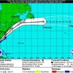
According to catastrophe modeling firm AIR Worldwide, as of the National Hurricane Center’s 11:00 a.m. advisory, Tropical Storm Andrea is moving northeastward at a speed of 15 mph with maximum sustained winds of 60 mph and some stronger gusts. Tropical storm winds extend outward 140 miles but primarily to the east of the storm’s center. The storm is expected to accelerate and continue on a northeast path later today, making landfall in Florida’s Big Bend. Andrea is not expected to intensify further before making landfall and if forecasts hold AIR…
Read MoreIrene Weakens to Tropical Storm as it Makes Landfall on New York’s Coney Island
BOSTON, Aug. 28, 2011 – According to catastrophe modeling firm AIR Worldwide, Irene deviated slightly from the NHC forecast track yesterday, taking a slight westward shift before resuming its north-northeast direction. This brought the center of the storm into New Jersey, near Little Egg Inlet, for its second landfall at 5:30 am this morning. Sustained winds, as reported by the NHC, were 75 mph. “It is worth noting, however, that as yet there have been no onshore wind observations of greater than tropical storm force since Irene made landfall near…
Read More


