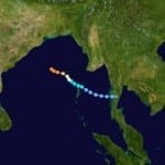
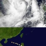
BOSTON, Oct. 15, 2013 – According to catastrophe modeling firm AIR Worldwide, Tokyo is bracing itself for its strongest typhoon since October 2004. Wipha, the eighth typhoon of 2013 and the 26th named tropical cyclone of the year, is a huge storm system currently moving northeastward toward Japan. It will likely follow the coast and pass close to Tokyo around the morning rush hour on Wednesday, bringing with it powerful winds and heavy rain. According to the Japan Meteorological Agency (JMA), as of 14 UTC on October 15, Typhoon Wipha…
Read MoreTag: flooding
Cyclone Phailin Makes Landfall in Odisha, India
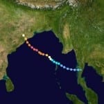
According to catastrophe modeling firm AIR Worldwide, Cyclone Phailin made landfall in the Indian state of Odisha at around 9:15 p.m local time on Saturday. The massive storm, at half the size of India according to satellite imagery, is the strongest to affect the country since 1999’s Cyclone Orissa, which killed nearly 10,000 people. Phailin is accompanied by strong winds, heavy rains, and damaging waves. Extensive property and crop damage is expected in the affected region. With power and communications cut off, damage information has been scarce overnight. A more…
Read MoreSevere Cyclone Phailin Could be Worst Cyclone in 14 Years
BOSTON, Oct. 11, 2013 – According to catastrophe modeling firm AIR Worldwide, currently several hundred kilometers off of the eastern coast of India, Very Severe Cyclonic Storm Phailin is expected to make landfall on Saturday evening, local time, north of the city of Visakhapatnam. The storm is expected to severely impact areas in the states of Odisha and Andhra Pradesh. AIR expects significant damage from this event. Heavy to very heavy rainfall over large areas of Andhra Pradesh and Odisha, along with extremely heavy rainfall in some areas, will likely…
Read MoreHurricane Manuel Returns to Soak Northwestern Mexico: AIR Worldwide
According to catastrophe modeling firm AIR Worldwide, after rapidly dissipating on Monday night and being downgraded to a remnant tropical low, Manuel reformed and strengthened back to hurricane intensity on Wednesday. The re-formation was aided by a reduction in wind shear over the past two days, as well as by the storm having moved back over the warm ocean waters off the western coast of Mexico. Hurricane Manuel slowly drifted to the north-northwest at about 5 mph. This track, coupled with the storm’s slow forward speed, resulted in Manuel remaining…
Read MoreDowngraded Tropical Storm Ingrid Makes Landfall on Mexico’s East Coast: AIR Worldwide
BOSTON, Sept. 16, 2013 – According to catastrophe modeling firm AIR Worldwide, Tropical Storm Ingrid had weakened from its Category 1 hurricane status by the time it made landfall near the small town of La Pesca on the eastern coast of Mexico between 6:00 and 7:00 a.m. CDT this morning. The National Hurricane Center’s 7:00 a.m. CDT Public Advisory reported that an Air Force Hurricane Hunter aircraft and radar imagery had confirmed that Ingrid had made landfall and that the storm’s wind speed had not increased in intensity as anticipated…
Read MoreTropical Cyclone Utor Slams Philippines, Heads Towards China’s Coast
According to catastrophe modeling firm AIR Worldwide, Typhoon Utor slammed into the northern Philippine island of Luzon on Monday, August 12, at around 3:00 pm local time (7:00 UTC) with 10-minute sustained winds of 175 km/h (109 mph, JMA), gusts of up to 210 km/h (130 mph, JMA), and waves up to 2.5 meters high. Utor’s strength at landfall was a Category 4 Super Typhoon, but it weakened to a Category 2 as it moved over the island. Once again over warm open waters of the South China Sea (with…
Read MoreFloodwaters Inundate Southern Alberta; Cleanup Continues
According to catastrophe modeling firm AIR Worldwide, heavy rainfall from June 19 to June 21 caused serious flooding across Southern Alberta, notably in Calgary. Roads and bridges were washed away; notably, the Trans-Canada Highway was damaged by mudslides west of Calgary. As of June 28, power has been restored to much of Calgary, and the Trans-Canada Highway has been repaired west of Calgary. However, many buildings in the affected area still have flooded basements, and cleanup efforts are anticipated to continue for some time. According to AIR, starting the evening…
Read More


