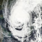
BOSTON, Oct. 16, 2013 – According to catastrophe modeling firm AIR Worldwide, although Typhoon Wipha did not make landfall on Japan’s main island of Honshu today,as had been expected, the storm brought soaking rain and gusty winds to much of both Honshu and Hokkaido, including the Tokyo region, which experienced a total of 150-300 mm (6-12 inches) of rain. Tokyo International Airport reported some of the highest sustained wind speeds in Japan from this storm: 79 km/h (49 mph) 10-min sustained and a 116 km/h (72 mph) gust. However, Tokyo…
Read MoreTag: flood news
In the Aftermath of Cyclone Phailin, Significant Damage Reported: AIR Worldwide
BOSTON, Oct. 15, 2013 – According to catastrophe modeling firm AIR Worldwide, around 21:15 local time (15:45 UTC) on Saturday, October 12, Very Severe Cyclonic Storm Phailin made landfall on the eastern coast of India near Gopalpur in Odisha. Phailin was a large storm, with gale force winds (>63 km/h) extending 250 km on either side and storm force winds (>93 km/h) extending 100 km on either side. Results of simulations of Phailin using the AIR Tropical Cyclone Model for India indicate that insured wind losses to onshore properties in…
Read MoreFloodwaters Inundate Southern Alberta; Cleanup Continues
According to catastrophe modeling firm AIR Worldwide, heavy rainfall from June 19 to June 21 caused serious flooding across Southern Alberta, notably in Calgary. Roads and bridges were washed away; notably, the Trans-Canada Highway was damaged by mudslides west of Calgary. As of June 28, power has been restored to much of Calgary, and the Trans-Canada Highway has been repaired west of Calgary. However, many buildings in the affected area still have flooded basements, and cleanup efforts are anticipated to continue for some time. According to AIR, starting the evening…
Read MoreHeavy Rains Cause Record Flooding and Landslides across Central Europe: AIR Worldwide
According to catastrophe modeling firm AIR Worldwide, Central Europe has been inundated during the past several weeks with heavy and relentless rain, which has resulted in some of the worst floods seen in the area in more than 70 years. The floods have reached record levels, particularly in Germany, Austria, and the Czech Republic. Switzerland, Hungary, Slovakia, and Poland are also affected. The heavy rains are resulting in landslides in many mountainous areas, while in the floodplains, which were already saturated due to rains in previous weeks, river levels rose…
Read MoreFloods Associated with Ex-Tropical Cyclone Strike Eastern Australia
According to catastrophe modeling firm AIR Worldwide, flooding has hit parts of eastern Australia, forcing thousands of residents to evacuate their homes. The heavy precipitation over the past week is associated with ex-tropical cyclone Oswald and was enhanced by a monsoon trough, an elongated area of low pressure that moved south along the Queensland coast into New South Wales. Floodwaters cut off rural communities, damaged homes, caused massive power outages, and disrupted coal mining operations. Water levels are slowly receding on most rivers, but dozens of flood warnings still remain…
Read MoreTyphoon Sanba Makes Landfall in South Korea: AIR
According to catastrophe modeling firm AIR Worldwide, Typhoon Sanba made landfall on September 17 just before noon local time (3:00 UTC) in South Gyeongsang Province on the southern coast of South Korea. Maximum sustained winds at landfall were around 150 km/h (equivalent to a Category 1 hurricane on the Saffir-Simpson Scale). Sanba subjected both South and North Korea to winds and heavy rains in its north-northeast trek across the peninsula, causing flooding and landslides, transportation service disruptions, and power outages. Significant insured losses in South Korea are not expected from…
Read MoreTenacious Isaac Continues to Deliver Heavy Precipitation to Louisiana
BOSTON, Aug. 30, 2012 – According to catastrophe modeling firm AIR Worldwide, by 1:00 p.m. CDT this afternoon, August 30, Tropical Storm Isaac was continuing to move slowly northwestward over northern Louisiana producing heavy rains, gusty winds, and high water levels along the northern Gulf coast. The storm, which remains very large, slowly continues to weaken. However, 36 hours after initial landfall, maximum sustained winds as reported by the National Hurricane Center (NHC) are still 40 mph. The storm is expected to continue weakening gradually and it will likely be…
Read More


